

 InfoSearched
Japan Prioritizes Analysis During Seismic Events
The Prime Minister’s Office of Japan built this feature around a simple fact: satellites can see disaster damage that rescue crews on the ground cannot. It walks through how the Japan Aerospace Exploration Agency (JAXA) turns its Earth observation fleet into an emergency response tool, mapping landslides, liquefaction, and flooding within hours of a quake or storm. The centerpiece is ALOS-2, known in Japan as “DAICHI-2,” a radar satellite that doesn’t care whether it’s midnight or whether the sky is choked with cloud.
- ALOS-2’s L-band Synthetic Aperture Radar (PALSAR-2) can image the ground through cloud cover and darkness, something optical satellites can’t do.
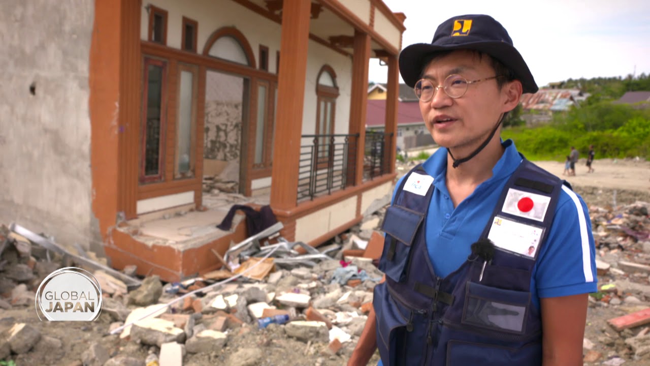
- Following the September 2018 Sulawesi earthquake and tsunami in Indonesia, JAXA’s satellite data mapped soil liquefaction, landslides, and coastal inundation to guide rescue routes and reconstruction.
- JAXA also deployed ALOS-2 immediately after the September 2018 Hokkaido Eastern Iburi earthquake to assess massive coseismic landslides and ground displacement.
Radar Outperforms Cameras in Disaster Zones
Optical satellites are useless the moment a typhoon’s cloud deck rolls in or the sun goes down — exactly the conditions that follow most major disasters. ALOS-2’s PALSAR-2 instrument sidesteps that problem entirely by bouncing L-band radar wavelengths off the ground and reading the return signal, day or night, rain or clear. That’s the technical edge the video leans on to explain why Japan built its disaster-response satellite program around radar rather than conventional imaging, an approach detailed further in How Tech Designed for Space Is Saving Lives on Earth.
Sulawesi: Mapping a Liquefaction Disaster
When the September 2018 earthquake and tsunami hit Sulawesi, entire neighborhoods in Palu turned to liquid as the ground liquefied beneath them. JAXA’s satellite passes over the region produced radar-derived maps of where liquefaction had spread, where landslides had cut off roads, and how far the tsunami had pushed inland along the coast. That data went straight into the hands of responders planning rescue routes and, later, into the reconstruction plans for rebuilding the hardest-hit districts.
L-band radar penetrates cloud cover and operates day or night regardless of severe weather — delivering situational mapping when optical satellites and ground access are blocked.
Hokkaido: A Domestic Test of the Same System
Japan didn’t have to wait for a request from abroad to prove the system worked — the same September 2018 window brought the Eastern Iburi earthquake to Hokkaido. ALOS-2 was mobilized immediately, and JAXA used its radar data to rapidly assess the scale of coseismic landslides and ground displacement across the affected area, giving domestic emergency planners a fast read on where the terrain itself had become the hazard.
Sharing the Data Across the Asia-Pacific
Japan doesn’t keep this capability to itself. JAXA acts as executive secretariat for Sentinel Asia, a regional initiative that distributes satellite-derived disaster analysis to countries across the Asia-Pacific, and Japan also participates in the International Charter “Space and Major Disasters,” which provides emergency observations and damage mapping free of charge to nations hit by catastrophe. Between the two frameworks, a radar pass over a disaster zone can turn into usable maps for foreign responders within a matter of hours.
For more on how space-derived tools are moving from orbit into everyday emergency response, see The next generation of space technology (Studio) or browse the Space Technology archive.
The next time a major quake or tsunami hits anywhere in the Asia-Pacific, the pattern will likely repeat: ALOS-2 passes overhead, PALSAR-2 reads the ground through whatever weather is in the way, and JAXA pushes the resulting maps out through Sentinel Asia and the International Charter before ground teams have even finished clearing the first road.





Tesla Autopilot Drives Straight Towards Concrete Barrier on Highway
New technology makes troops invisible
8 Medical Procedures That Are Improving Lives
Working Mandalorian Helmet with HUD! – See 500 Feet In Total Darkness!
Hyperloop Explained | The B1M